Table of Contents
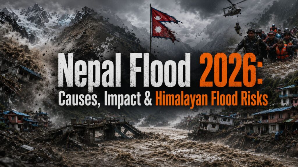
The Himalayas are warming at a rate that many do not realise, and that is altering how floods play out in mountain areas. We see that glaciers, permafrost and unstable slopes, when they interact, cause a great shift which may see huge amounts of water, ice and debris sent into valleys below. Nepal is dealing with one of its most disastrous events in years.
In August 2026, a flash flood hit the border region, killing a thousand and leaving many more missing. Unlike monsoon-related flooding, which we see in the plains, this disaster began high up in the mountains where a glacier failed. The blog explains how climate change and unstable mountain conditions can turn a glacier or landslide event into a deadly flash flood, and why Himalayan communities need better warning and disaster-preparedness systems.
In August 2026, a flash flood hit the border region, killing a thousand and leaving many more missing. Unlike monsoon-related flooding, which we see in the plains, this disaster began high up in the mountains where a glacier failed. The blog explains how climate change and unstable mountain conditions can turn a glacier or landslide event into a deadly flash flood, and why Himalayan communities need better warning and disaster-preparedness systems.
What Happened in Nepal on 26 August 2026?
On 26 August 2026, a powerful flash flood hit the Nepal–China border region. It damaged the Gyirong border area and swept through settlements along the Trishuli River Valley.
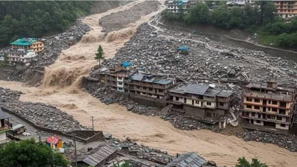
The flood destroyed homes, roads and bridges, leaving many communities cut off. Unlike a regular monsoon flood, it developed suddenly after a glacier- and landslide-related event in the mountains.
The disaster also affected areas on the Tibetan side of the border. It has raised concerns about the growing risk of sudden floods in the Himalayan region.
The flood destroyed homes, roads and bridges, leaving many communities cut off. Unlike a regular monsoon flood, it developed suddenly after a glacier- and landslide-related event in the mountains.
The disaster also affected areas on the Tibetan side of the border. It has raised concerns about the growing risk of sudden floods in the Himalayan region.
What Caused the Nepal Flood in 2026?
Geoscientists point to a collapsing glacier near the China-Nepal border as the trigger. A massive chunk of ice and rock broke away from the glacier and slid down the mountainside. This landslide carried enough force to register as a seismic event, and it sent a wall of water and debris crashing into the valleys below.
Early assessments have pointed to a complex chain of glacier, rock and debris movement rather than a conventional monsoon flood. Satellite observations and geological assessments are being used to determine whether a glacial lake outburst, glacier collapse, landslide, or a combination of these processes triggered the flooding.
Early assessments have pointed to a complex chain of glacier, rock and debris movement rather than a conventional monsoon flood. Satellite observations and geological assessments are being used to determine whether a glacial lake outburst, glacier collapse, landslide, or a combination of these processes triggered the flooding.
How Can a Glacier Collapse Trigger a Flash Flood?
When a glacier breaks apart, huge amounts of ice, rocks, mud, and debris can rush down the mountain. Rising temperatures can melt permafrost, which normally helps keep mountain slopes stable. When it weakens, glaciers and rocks can become unstable.
The sudden movement can block or disturb a river and create a flash flood, giving people downstream very little time to escape. Unlike some GLOFs, these events can happen with almost no warning.
The sudden movement can block or disturb a river and create a flash flood, giving people downstream very little time to escape. Unlike some GLOFs, these events can happen with almost no warning.
Why Is Nepal Particularly Vulnerable to Floods?
Nepal is in the heart of the Hindu Kush Himalaya range, which has thousands of glaciers and glacial lakes. Mountain valleys see villages, farms, and roads located in strips by the water. Mountain valleys do not provide much room for floodwater spread, which in turn puts settlements, roads, and farms very near to rapidly moving rivers.
Rising temperatures have caused glacier retreat, and we also see a change in the size and stability of some glacial lakes. We see that 15 million people worldwide are at risk from glacial lake outburst floods. And in large part, that risk is in Nepal and its neighbouring Himalayan countries. In 2024, Thame village, which had a GLOF report, also reported repeated flooding, which in turn is making residents question the liveability of their homes.
Rising temperatures have caused glacier retreat, and we also see a change in the size and stability of some glacial lakes. We see that 15 million people worldwide are at risk from glacial lake outburst floods. And in large part, that risk is in Nepal and its neighbouring Himalayan countries. In 2024, Thame village, which had a GLOF report, also reported repeated flooding, which in turn is making residents question the liveability of their homes.
How Do Himalayan Floods Affect India and Nearby Countries?
Himalayan rivers do not stop at Nepal’s borders. The Trishuli, Bhotekoshi and other rivers affected by this flood eventually feed into the Ganges-Brahmaputra river system.
Nepal’s rivers are part of larger river systems that flow into India and Bangladesh. Heavy rainfall and sudden increases in upstream discharge can therefore contribute to downstream flood risks, although the impact varies by river basin and weather conditions.
Nepal’s rivers are part of larger river systems that flow into India and Bangladesh. Heavy rainfall and sudden increases in upstream discharge can therefore contribute to downstream flood risks, although the impact varies by river basin and weather conditions.
Is Climate Change Increasing Himalayan Flood Risks?
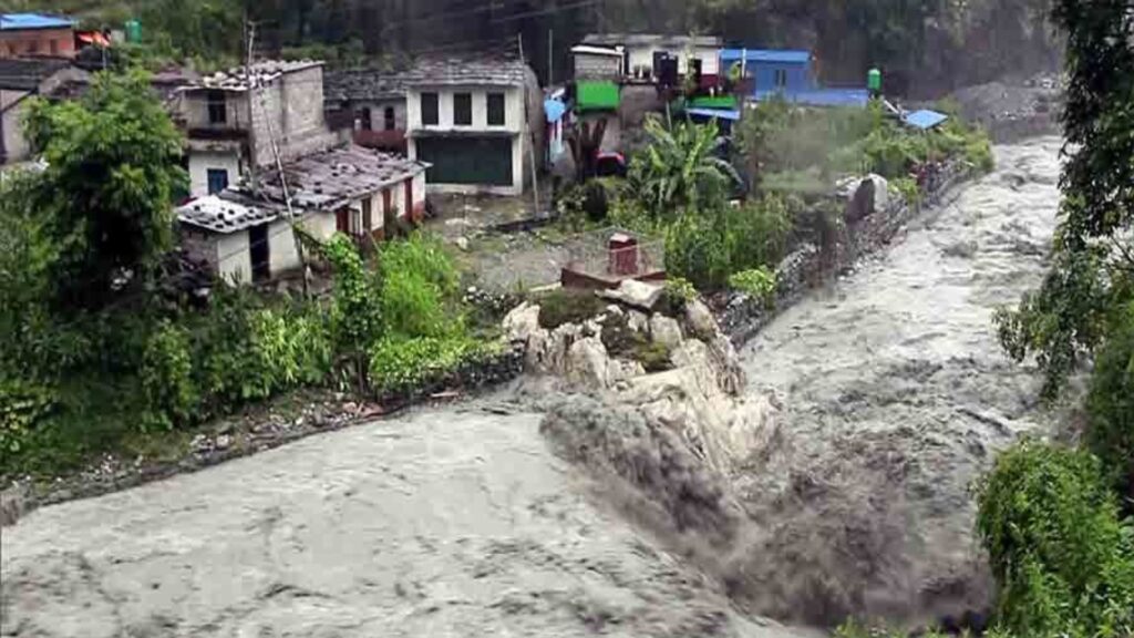
The event has renewed attention on how a warming climate can increase risks in high-altitude regions. Glaciers across the Hindu Kush Himalaya are retreating, while permafrost is thawing faster than in previous decades. Both processes destabilise mountain slopes that have held steady for centuries.
About 240 million people in mountain areas depend directly on glaciers for water, and another 1.65 billion people rely on rivers downstream. As glaciers keep retreating, researchers expect collapses, more GLOFs, and shorter warning windows for the communities living below them.
About 240 million people in mountain areas depend directly on glaciers for water, and another 1.65 billion people rely on rivers downstream. As glaciers keep retreating, researchers expect collapses, more GLOFs, and shorter warning windows for the communities living below them.
How Did the Flood Affect Roads, Homes and Hydropower?
Flash floods in mountain terrain destroy infrastructure that took years to build. This flood wiped out a border trade checkpoint, disrupting commerce between Nepal and China. Roads and bridges connecting villages to district headquarters collapsed, cutting off access for rescue teams and supply convoys for days.
Nepal generates most of its electricity from hydropower plants built along these rivers. Flash floods routinely damage dam structures, powerhouses, and transmission lines, triggering power outages from the flood zone itself. Rebuilding this infrastructure in steep, landslide-prone terrain takes months, years.
Nepal generates most of its electricity from hydropower plants built along these rivers. Flash floods routinely damage dam structures, powerhouses, and transmission lines, triggering power outages from the flood zone itself. Rebuilding this infrastructure in steep, landslide-prone terrain takes months, years.
How Can Himalayan Communities Prepare for Future Floods?
Better monitoring, faster warnings, and community planning can help reduce the impact of sudden floods. Communities in high-risk areas need to know the risks and have clear plans to reach safety quickly.
Monitoring
Satellite imagery, sensors and field surveys can identify changes in glaciers, lakes and unstable slopes.
Early warning
Warnings need to reach communities quickly through sirens, mobile alerts, radio and local authorities.
Community preparedness
People living in high-risk valleys need evacuation routes, drills and clearly identified safe areas.
Monitoring
Satellite imagery, sensors and field surveys can identify changes in glaciers, lakes and unstable slopes.
Early warning
Warnings need to reach communities quickly through sirens, mobile alerts, radio and local authorities.
Community preparedness
People living in high-risk valleys need evacuation routes, drills and clearly identified safe areas.
What Can Other Mountain Regions Learn From Nepal?
The main lesson from Nepal is that mountain disasters do not happen because of just one problem. Several changes can happen together and make the situation worse. This means other mountain regions should not wait for a disaster to happen. They need to regularly monitor glaciers, lakes, slopes and frozen ground. Early-warning systems can alert people before dangerous floods or landslides reach nearby villages, giving them time to move to safer places.